
Encounter with: Dana Abbas, Riwaq-Centre for Architectural Conservation
Story collected by: Rana Kobeissi, personal interview recorded on Zoom and transcribed.
Date and Place: January 2024, Palestine
Rana Kobeissi: The Absent Map project explores the hidden history of rural Jerusalem by exploring the concepts of map-making and counter-maps. How has this project influenced Riwaq’s work in the Jerusalem countryside? More broadly, what is your perspective on the role of the arts in preserving heritage?
-
Dana Abbas: The inception of the Absent Map project, when we applied to AFAC with it, was rooted in previous research Riwaq initiated, mostly in a project we had started in rural Jerusalem. This is the project we are currently working on, called The Life Jacket, where we work within rural Jerusalem to revive it socially, culturally and historically. However, the geopolitical situation of Jerusalem's villages, which are divided by the apartheid wall, posed significant challenges.
The idea of The Absent Map emerged from this context, as the existing map does not reflect any of Jerusalem’s history. Instead, it fragments and transforms it into small, marginalized communities that are not even able to live in a manner that is compatible with the expansive space. In pursuing The Absent Map, we had to consider all the concealed possibilities within this geographic field, re-document it, draw it, share it and contemplate how it can benefit future communities.
Work with art was a main thing in our project. By issuing an invitation for public participation and reaching out to artists, we opened the door for Palestinian artists to work with our prior research in Riwaq on rural Jerusalem — including maps, documentation, surveys, interviews, field interviews, restoration and revitalization experiments, and partnerships with institutions. The condition we had was that they be able to reach and work within this geographic area and consider rural Jerusalem as an accessible space for them at either side of the wall — the occupied side or the side that falls under the jurisdiction of the Palestinian Authority. The artists we ended up working with worked in three different areas: the villages of Beit Hanina, Jib and Qalandia.
It was important for us to grant the artists the freedom to approach these areas or even redefine the concept of the map through their own tools and interpretations of these geographies. All of the research conducted, the artistic interventions and the networks established during this project are integral to our project of reviving rural Jerusalem. We are building upon and working with these research findings and approaches. They have allowed us to unlock topics that we, as researchers and architects, had previously only superficially explored. But now, after having the opportunity to delve deeper, our perspective on rural Jerusalem has changed. We have been given new connections through which we can restore the area and its communities, their relations to their heritage, history and even each other.
RK: Could you tell us more about the process of mapping the absence itself, especially regarding the Beit Hanina valley? What hidden networks did this process reveal? And do you plan to use them to raise awareness around a specific alternative narrative? If so, how?
-
DA: The Beit Hanina project, as I mentioned earlier, was one of three projects. What sets this project apart is that it is focused on a village that has been divided by the wall. It can be considered an extreme case, compared to Qalandia, which is surrounded by the wall on all four sides, and Jib on three.
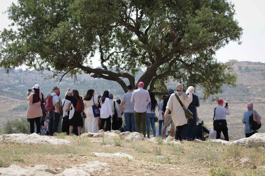
The effort to remap the valley started during the COVID-19 period, undertaken by a group called The Block, consisting of three Jerusalemite architect-artists who were living in Beit Hanina. The quarantine pushed them to go out and explore open spaces like the Beit Hanina valley. Each day during their walks in the valley, they encountered shepherds and sometimes young people playing among the tractors. They also noticed the footprints of livestock and came across the sprawling infrastructure servicing the seven settlements built on the lands of Beit Hanina’s residents: sewage systems, electric extensions and service bypass roads.
For the artists, the central question became: how do we reclaim the valley as Palestinians and as residents of Beit Hanina? How do we restore our perspective of the valley by thinking of it as a space that enables us to fuse this geographical divide between the two sides, meaning the old Beit Hanina behind the wall and the new side? And how do we restore the relationship between the residents of Beit Hanina and the valley?
The artists drew inspiration from the memoirs of Orientalist travelers who had the opportunity to explore the geography of our country. These travelers narrated, described and imagined the landscape based on their own contexts and backgrounds. Their memoirs consisted of imaginary drawings that described and delineated this geography.
The group decided they would adopt a similar approach but toward a positive end. Thus, they began visiting the valley on a weekly basis, writing their memoirs, sketching, taking notes and recording audio and video.
The artists were able to access the valley with the help of a shepherd there who acted as their guide, introducing them to different places and their names. Through these regular trips, they had the opportunity to meet the people of Beit Hanina and learn about the valley's stories through them.
Among the people they met was Abdullah Daais, a history professor and novelist who has lived on both sides of the village and was forced to seek refuge in Jerusalem after the construction of the wall.
He told them about Wadi al-Sarar — which Beit Hanina is a part of — and how it serves as a primary water source in Palestine, especially during the winter. The agricultural seasons rely heavily on the water from the valley. Daais explained that the Western lands of Beit Hanina, currently under Israeli municipal control, were originally designated for wheat cultivation.
This made the valley a cherished place, even for children, who would play, swim and boat in its waters.
The maps created by the artists depict vivid representations of the journeys they took over the course of one year, with each of the eleven routes of their walking trips having a name and a description that documented a part of their personal experience and a segment of the valley's history.
The research therefore addressed the two sides of the valley, exploring the history of Beit Hanina — the old town — and its people’s connection to the valley. It also highlights the main paths used by the residents to cross to the other side.
This is the map they were able to draw, a map with eleven routes. What sets it apart is that it is accessible to all hiking enthusiasts, who can use it to explore the valley, read the associated narratives and construct their own narratives.
RK: You have adopted a participatory, bottom-up approach to research, an approach that recognizes members of society as knowledge holders and partners in knowledge production. What made a popular, collaborative approach significant in this context? And what are your expectations for the future efforts of Riwaq and other institutions in this regard?
-
DA: In my opinion, when it comes to cultural work, particularly in the heritage sector, it is impossible to work without people. Without them, you detach yourself from the concept of heritage itself. If you do not work with those who produce heritage, you will ultimately be someone who looks at things superficially.
Since its inception, Riwaq has built its knowledge, including traditional structures and their values and ethics, through our work with people on the ground. This approach has influenced our physical work in restoration and reconstruction, as well as our cultural program.
In our cultural program in particular, we always begin a project by working on the ground, immersing ourselves in the community. For example, if I’m working in Jib, all the residents there should be aware that Dana is the architect from Riwaq. We must be a part of this community.
Ultimately, Riwaq is an institution that works for these communities, where our presence is temporary. We may work, for instance, for a whole decade in a location and then leave. Who will carry on the project we started? Who will continue the revitalization efforts? The communities themselves —property owners, institutions, municipalities, neighbors and schools. It is crucial for these diverse groups to embrace and take ownership of any project right from the start.
This approach is most evident in our cultural program, as its success hinges on engaging with people and ensuring that the outcomes are meaningful for them. Our project in the rural areas of Jerusalem with AFAC — the Absent Map project — was based on the idea of revitalizing the people’s map. We wanted to move away from official maps, including municipal maps that focus on built areas, green spaces and land classification. Instead, we sought to view this geography solely through the lens of the people.
The second important aspect is that we draw maps of intangible elements of the environment. Going beyond creating maps of topography, buildings, or trees, we draw maps of practices, crafts, water paths, grazing routes and school routes. A significant part of these maps captures movements or flows that express life. A geography without flow is a lifeless geography.
This is the kind of mapping we engage in, and that is why we can only work in an incremental manner. Our work has a fluid nature — sometimes we draw from books and then from people. We walk with people and sit down with historians. We reach a level of immersion into the geography itself. For example, when Raghad Saqf al-Heit worked on her project which focused on clay, she looked for places where clay exists to revive its local recipes.
Regarding the second part of the question, most Palestinian cultural institutions were formed as an attempt to fill a clear gap. Riwaq is a product of the moment that began in the early 1990s when the first intifada, while nearing its end, still had a momentum that lingered in people's hearts. It was during this period that various initiatives took root and were becoming established institutions, like the initiatives related to dabke, restoration and music. Consequently, the modus operandi of “The Absent Map” is a process that aspires to extend from the Palestinian experience in the cultural sector, and to become a model for new mechanisms and ways of working with and through the community.
Certainly, the shifting funding landscape represented a big challenge for us. With the rise of the culture of external funding, we were inundated with irrelevant projects. There was also a tendency for categorization in a specific manner that was in line with the funders’ agendas. The challenge was to find our own place amid this reality. At times, we found ourselves confined to parameters set by funders. However, we eventually imposed our agenda and worked in our own way, with our own tools. Over time, Riwaq developed the confidence to assert its own approach to any funder. We seek partners who value social engagement, as we believe it is integral to our work. For instance, we view communities as essential partners, as integral parts of a larger whole – a community or neighborhood, rather than as separate entities, such as women, children and others.
That is why a grant like AFAC’s provided us with an experimental space that allowed us to expand the boundaries of this approach and present it to practitioners from backgrounds that are different from ours. Even in our role as evaluators within this project, we engaged in constant discussions with the artists, to develop the tools and methods that best suited each’s work. We did not impose strict deadlines and deliverables. Instead, we focused on monitoring each person’s progress, as we believe that progress is the real achievement. We know how difficult the components they’re dealing with are because it is new knowledge that has not been documented previously.
RK: How can the research developed by Riwaq contribute to the communities you have worked with, ensuring that the relationship is not solely based on taking from them?
-
DA: From the very outset of the project, particularly with AFAC, we approached the relationship not as one of give and take, but rather as a cycle of knowledge intersecting in various spheres. The information we obtained from these communities also flowed back into them and in other locations. Even when we produced graphs to study the cycle of knowledge production after the project concluded, it became clear that the work was a flow of knowledge that permeated multiple domains.
Initially, we had a desk research phase to provide a framework for the research, followed by the exploratory phase that required immersing ourselves in the communities. The desk research phase was important to contextualize our choice of a specific area or geography, as well as the existing knowledge surrounding it. Subsequently, we pieced together the project background by sifting through all the knowledge obtained from oral histories and creating tools to reconnect the pieces of that geography. We gave access to our network of friends and acquaintances, and they started visiting the artists in their homes or going on excursions with them and conducting interviews. The knowledge seemed to transform into workshops or interventions within those places. The whole idea behind these workshops or interventions is the pivotal moment when all this knowledge transforms into shared and public knowledge.
For example, after completing the research phase of her project, Raghad engaged in reviving traditional techniques of pottery making.
Unfortunately, all the generations that worked with this clay recipe are dead. The last potteress passed away in 2011. However, her grandchildren and neighbors still remain.
What Raghad did was bring the grandchildren and neighbors together and conduct a public workshop open to anyone from Palestine. Some people from Nasirat, Jerusalem, Ramallah and Nablus even registered for it.
We began by consulting the departed potteress’s family. Each member offered their recollections of her work. Some remember how she used to grind materials and put them together. Others remembered how she used to shape the clay and some of the walks she took with grandchildren to collect stones and clay.
All of a sudden, the recipe emerged like a puzzle where the pieces are collected from everyone. Simultaneously, we tried it out with ceramic artists and potters who shared their professional sensibility.
They recounted what the departed potteress did and didn’t do and the materials that were once abundant but have since disappeared. This knowledge provided insight into the reasons behind why the craft changed and why new production techniques were adopted. Even the Occupation itself played a role in the craft’s decline — when walls are erected, or when Mount Matayen, the primary source of clay, becomes part of a settlement that people cannot enter, that heritage is bound to disappear.
Ultimately, you realize that the craft is geography — it is production and sales lines; it is local knowledge that needs some kind of constant communication to foster its development, that needs a geographical place to procure materials and model them. Under the political circumstances our people are living in — the geography that is being stolen from us and our inability to access our resources — many crafts have vanished. It is shallow to claim that people no longer work with their hands or that there was no documentation of our craft. It is necessary to recognize the impact of 75 years of erasure, where geography and everything that connects humans to it has been erased.
RK: Are you planning to showcase the knowledge generated from the research (interviews, documentation, mapping of memories, etc.) to a wider audience, as it is currently not reflected in the artistic output?
-
DA: In our project, we have employed two methods to document and present the research: the first method is a book titled Cityless Country — Side which is available for purchase on the Riwaq website. It includes the documentation of the research, providing insights into all the publications and their connection to their geography. Partnering writers have contributed to the writing of this book in the form of research material under the scope of the work of the groups.
The second method is a website that features the maps and serves as a valuable archive for the artists’ outputs and the project’s experiments. We are currently working on a complete update of the Riwaq official website and aim to link the projects’ website to it. We also hope that this website will inspire other practitioners to build on this type of knowledge.
The website contains a lot of audio recordings. However, the oral history required a lot of editing because the interviews conducted were extensive, covering both personal and public aspects. Nevertheless, we have managed to put together a significant collection of recordings that are directly relevant to the research.
RK: This project contributes to the broader conversation on counter-mapping. How do you envision the work and its continuity in the current situation in Palestine? Do you plan to use counter-mapping as a tool to preserve Palestinian cities?
-
DA: I believe that we are aware that counter-mapping takes various forms. There are many hiking groups trying to bring back a Palestinian physical presence to allow Palestinians to talk about their geography, re-map their roots and see the land as an integral part of our rootedness in these geographies, especially since a large part of this land has either been taken for settlements or confiscated by the Occupation forces That is why it was a challenge to reconsider it as part of our territories.
We consider our work to be not far from re-drawing counter-maps that carry a kind of resistance against all attempts to use the map to deprive Palestinians of their geography. Official maps produced by human rights institutions, such as the United Nations Office for the Coordination of Humanitarian Affairs and others, often capture only one aspect of the conflict that Palestinians actually experience on the ground. They turn geography into a non-sensory abstraction. But geography is not abstract — it is a whole life. Therefore, our work must go beyond simply redrawing lines on paper — it is about creating counter-maps. We see our work as an integral part of the current practices that work on redefining maps and try to convey a different reality of the Palestinians’ presence on their land.
While many entities focus on cities, we have directed our attention to the farmer and the village. The countryside— which holds about 50 percent of Palestinian architectural heritage and most Palestinian intangible heritage, such as songs and music — is often neglected, despite encapsulating the lives of both farmers and Bedouins.
Another reason we focused on the countryside and farmers is that city dwellers tend to write about and document their own experiences. The people of Yafa have written and the people of Jerusalem continue to write about their experiences. Many of our Palestinian historians come from urban backgrounds and have written about their cities and the cultural life within them. However, there are few writers who have documented the countryside and its cultural life.
Of course, after the Nakba, there emerged a kind of terrifying documentation of the countryside and villages, but it was like a fever, driven by a desperate need to preserve what remains of our memory.
In our opinion, we are now in a different historical stage in which we look forward, not just toward the past. These practices — whether documentation or reimagining geography — are crucial. We used to talk about the importance of imagination, because if we, as Palestinians, cannot imagine what we want for the future, it will be difficult to navigate this stage and find our direction.
We always talked about wanting to imagine that this wall does not exist, because somewhere in our future, we imagine that the Occupation will be dismantled and will disintegrate, and that this geography will reconnect.
If we do not work from now to ensure that the gap between these geographies does not increase, we will feel like strangers, distant from one another.
The current stage we are in still contains the history of our ancestors: there is a generation that experienced the Nakba, and there is our generation that has witnessed various intifadahs. We are now living in the worst stage of our history in light of the ongoing genocide in Gaza. If these experiences do not bring hope to the generation that follows us, showing them how we constantly strived to unite this geography and resist those who claim that the stagnant situation we are in is reality, then we have done a disservice to ourselves and to future generations.
All of the practices that we deploy in the field of cultural heritage, especially in revival and restoration, are conversations about a future life that will be connected to all this heritage and history. For us, restoration that goes hand in hand with knowledge transfer is the only way to successfully revive heritage in Palestine under these difficult conditions.
Furthermore, I have always felt that history in our country is dominated by men. But when you enter the Palestinian countryside, you realize the extent to which history is dominated by women. It was fascinating for us how much knowledge we produced with women from various generations, from the elderly to the young. It was striking to us how humble they were with sharing private knowledge — something we do not often find among the men who usually share general history.
Our women, with their humility and engagement with the details of life, have become an endless source of knowledge. The interviews we conducted opened our eyes to this. Pottery, for example, is a craft exclusively practiced by women in rural areas, and knowledge in agricultural geography is very much held by women.
When we talk about the history of the city, we say that it is a history dominated by men. But the history of the countryside is undoubtedly built on women’s knowledge and therefore that knowledge deserves to have a preeminent place within that history. Everyone agrees that there is a forgotten history there, and it is necessary for us to listen attentively and give space to women to speak about this history.
About the project
The present project is a research on the hidden histories of rural Jerusalem, through the experimentation with themes and notions of mapping and counter-mapping. The project aims at emancipating a colonial projection of the city’s history, and a national imagination of icons and symbols, by bringing the agrarian communities of rural Jerusalem to the heart of the process of history-making.
Through the course of one year, Riwaq opened up its research on rural Jerusalem through an online platform that will serve as a counter-map/anti-map. This platform was further nourished by the inputs of creative interventions from various disciplines - artists, architects, and anthropologists, who will be invited to develop their research-based interventions within the Jerusalem area. Being an action-based research and perceived as a voicing tool, Riwaq intends to open this platform for the wider public of Jerusalemites and other contributors, to further expand the map's geography.
About Riwaq
Since 1991, Riwaq has recognized the challenging complexities of preserving Palestinian collective memory through projects that document and restore architectural heritage sites across the West Bank and Gaza. Harnessing the energy and skills of students, architects, archaeologists, and historians, Riwaq embarked on the Registry of Historic Buildings, a thirteen year project (1994-2007) resulting in the publication of three volumes that include detailed histories, maps, and photos of approximately 420 villages in sixteen districts across the West Bank, Jerusalem, and Gaza.
Riwaq's projects are not only about job creation, or about the restoration of stones and historic structure, it is also is about raising awareness about the importance of cultural heritage as a pillar for Palestinian identity and collective memory. It is also about creating a space suitable and safe for life and work, and it is about production and dissemination of knowledge.